
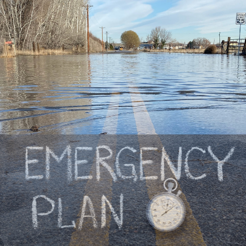
Rising Waters: What Miles City Homeowners Need to Know
What is FEMA?
FEMA is the Federal Emergency Management Agency which is a federal agency within the Department of Homeland Security dedicated to disaster preparedness, response, and recovery across the United States
FEMA works across three phases of disaster management
- Before Disasters: Raising awareness, designing warning systems, and developing prevention strategies
- During Disasters: Coordinating emergency response, evacuations, and resource distribution
- After Disasters: Overseeing recovery efforts and providing essential support to affected communities
FEMA’s Flood Insurance Role

The Administrators
FEMA (Federal Emergency Management Agency) administers the National Flood Insurance Program (NFIP)
The NFIP was created by Congress in 1968 through the National Flood Insurance Act, and it has been managed by FEMA since 1979
The program is specifically managed through FEMA’s Federal Insurance and Mitigation Administration (FIMA)
As of 2025, FEMA administers the NFIP by working with a network of more than 50 insurance companies to deliver flood insurance to the public
FEMA’s role in administering the NFIP includes
- Ensuring insurance applications are processed properly
- Determining correct premiums
- Handling policy renewals, reforms, and cancellations
- Processing insurance claims
- Overseeing the floodplain management and mapping components of the program
FEMA’s Risk Rating 2.0 falls under FEMA’s role in administering the National Flood Insurance Program (NFIP), specifically within the responsibility of determining correct premiums
By Implementing Risk Rating 2.0, FEMA is attempting to fulfill its responsibility to determine individual premiums more accurately, ensuring that policyholders pay rates that better reflect their property’s actual flood risk
FEMA’s Risk Rating 2.0

Fully Implemented in 2023
Risk Rating 2.0 is FEMA’s new methodology for setting flood insurance premiums under the NFIP
It was fully implemented as of April 1, 2023, and aims to provide more accurate and equitable flood insurance pricing
The New System
- Uses modern technology, flood models, and data to calculate more precise risk ratings
- Considers multiple risk factors such as flood frequency, property characteristics, and cost to rebuild
- Evaluates flood risk on a property-by-property basis, rather than using broad flood zones
Why Change was Needed

When Rock Bottom has a Basement
FEMA’s decision to change the rating system for flood insurance through Risk Rating 2.0 was driven by several factors including:
- Outdated methodology: The previous system had remained largely unchanged since the NFIP’s creation in 1968, using an outdated model for determining flood insurance costs
- Limited risk factors: The old system primarily considered flood zone, property elevation, and occupancy type, which did not provide a comprehensive assessment of flood risk
- Inequitable pricing: Under the previous system, lower-value properties often subsidized higher-value properties, creating pricing disparities
- Lack of individualized assessment: The old method relied on grouping properties into broad categories rather than evaluating individual risk factors
- Incomplete risk consideration: Previous rates only accounted for river and coastal flooding, overlooking other types of flood risks
- Technological advancements: Modern technology, flood models, and data allow for more accurate risk assessment and pricing
What Changed?

Drum Roll, Please….
FEMA’s Risk Rating 2.0 introduced several significant changes to FEMA’s flood insurance pricing methodology which included:
- Individualized risk assessment: The new system evaluates flood risk on a property-by-property basis, rather than using broad flood zones
- Multiple risk factors: Risk Rating 2.0 considers various factors including:
- Frequency of flooding
- Proximity to water bodies
- Property characteristics (type of construction, elevation)
- Cost to rebuild
- Propensity for excessive rainfall
- Number of prior claims
- Modern technology and data: It uses the latest technology, flood models, and data to calculate more precise risk ratings
- Equity in pricing: The new system created more equitable insurance rates, ensuring policyholders pay premiums that accurately reflect their property’s flood risk.
- Lower-value properties no longer subsidize higher-value properties
- Improved transparency: Risk Rating 2.0 provides more accurate, science-based rates upfront, allowing consumers to make better-informed decisions about flood risk and insurance costs
What Didn’t Change?

New label, Same Contents
Despite the significant changes introduced by Risk Rating 2.0, several elements of the National Flood Insurance Program (NFIP) remained consistent:
- Legal caps on premium increases: The NFIP must still adhere to existing legal limits on annual insurance premium increases. Qualifying rates cannot increase by more than 18% per year
- Use of Flood Insurance Rate Maps (FIRMs): FEMA continues to use FIRMs for mandatory purchase requirements and floodplain management. These maps remain a source of flood mapping data for communities
- Premium discounts: Risk Rating 2.0 maintained prior discount opportunities, including premium reductions for properties mapped before and after the introduction of FIRMs.
- Communities participating in the Community Rating System can still receive NFIP rate discounts between 5% and 45%
- Miles City Community Discount is 15%
- Policy transfer discounts: Policyholders can pass on their discounts to new owners by transferring their flood insurance policy when the home is sold
- Maximum coverage limits: The NFIP policy is still not a guaranteed replacement cost policy and maintains a maximum coverage limit of $250,000 for single-family homes
FEMA’s Implementation of Risk Rating 2.0

Roll It Out!
Risk Rating 2.0 was implemented in two phases
- Phase 1: Began October 1, 2021, applying to new NFIP policies and existing policyholders who could benefit from the new pricing
- Phase 2: Started April 1, 2022, applying the new rating system to all existing policies as they came up for renewal. This phase was completed on April 1, 2023
Impact on Premiums
- Under Risk Rating 2.0, most policyholders (96%) were expected to see decreases or increases of no more than $20 per month
- Rate increases are capped at 18% per year
- The average annual cost of flood insurance from the NFIP increased
What Implementation Meant for Miles City, MT

Felt it in My Bones
FEMA’s implementation of Risk Rating 2.0 had significant implications for Miles City, MT because the city has been a participating community in FEMA’s National Flood Insurance Program (NFIP) since February 1, 1980, when its initial Flood Insurance Rate Map (FIRM) was established
Participation is important considering that approximately 77% of structures within Miles City are located in the flood zone, with roughly 5.5% in the floodway
In 2010, a digital FIRM of the Miles City area was made available, providing more detailed flood risk information
Under the NFIP, most of Miles City is designated as Zone AE
This classification indicates that the area falls within the Special Flood Hazard Area (SFHA) and has a 1% annual chance of flooding, as determined by detailed hydraulic analysis. Over the course of a 30-year mortgage, this translates to a 1 in 4 chance of flooding
The high percentage of structures in the floodplain underscores the importance of flood insurance for Miles City residents and the potential impact of Risk Rating 2.0 on insurance premiums and flood risk assessment for individual properties
If you are building or buying a house in Miles City, MT, there is a good chance you will be in the flood zone and if you are getting a loan to buy or build, you will be required to purchase flood insurance
FEMA provides information about the impact of Risk Rating 2.0 on Montana as a whole
As of 2021, when Risk Rating 2.0 was implemented, Montana had approximately 4,300 NFIP policies in force, with a significant portion concentrated in Custer County
The implementation of Risk Rating 2.0 affected Montana’s policyholders in varying ways:
- 37% (1,618 policies) were projected to see a decrease in premiums.
- 58% (2,512 policies) faced increases of up to $10 per month ($120 per year).
- 3% (131 policies) expected increases between $10 to $20 per month ($120 to $240 per year).
- 2% (79 policies) anticipated increases exceeding $20 per month ($240 per year)
FEMA’s Risk Rating 2.0 represents a significant shift in how flood risks are assessed and priced
Property owners in flood-prone areas, like Miles City, MT must stay informed about these changes to ensure they have adequate and cost-effective coverage.
Regularly reviewing your flood insurance policy, understanding your property’s specific risk factors, and consulting with insurance professionals can help you make informed decisions

Leave a Reply