
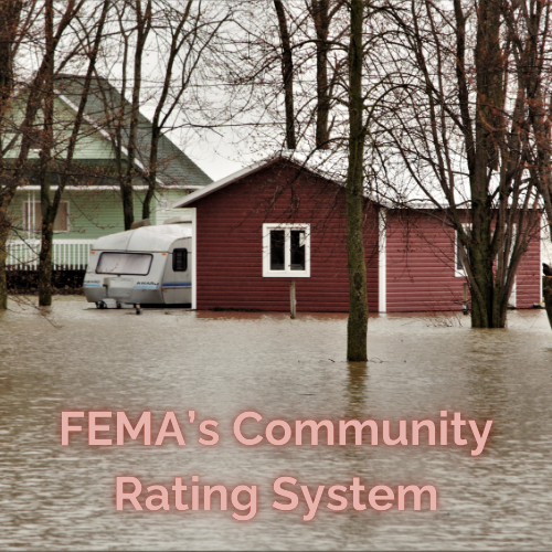
FEMA & The Community Rating System
Classification System with Incentives
FEMA’s Community Rating System for Flood Insurance in Miles City, MT, is derived from its authority in administering the National Flood Insurance Program (NFIP)
The National Flood Insurance Program (NFIP) is a federal program created by the United States Congress through the National Flood Insurance Act of 1968
The NFIP was established in response to the lack of availability of private flood insurance and the increasing costs of federal disaster assistance due to floods
The program is managed and administered by the Federal Emergency Management Agency (FEMA) through the Federal Insurance and Mitigation Administration (FIMA)
NFIP Has 2 Primary Purposes
- To provide access to flood insurance for property owners in participating communities, allowing them to transfer some of their financial risk to the federal government
- To reduce flood damages by implementing floodplain management standards and restricting floodplain development
The History: We’re Here Because We Were There, and There, is Not the Place to Be

Too Risky!!
Prior to 1968, flood insurance was largely unavailable or unaffordable for most property owners in the United States
Private insurers had largely withdrawn from offering flood coverage by the 1960s.
Flood was viewed as an uninsurable risk by most insurance companies, especially after frequent widespread flooding along the Mississippi River in the early 1960’s
Flood Risk Was Uninsurable Due To:
- The catastrophic nature of flooding
- Difficulties in creating accurate risk assessments for policy pricing
- Risks of adverse selection
The lack of available and affordable flood insurance led to Congress establishing the National Flood Insurance Program in 1968, with the goal of providing flood insurance protection to property owners in participating communities
If a community does not participate in the NFIP program residents of the nonparticipating community may not purchase NFIP policies
NFIP policies are only available to individuals in participating communities because participation ensures that the community adopts and enforces minimum floodplain management regulations
This requirement is part of a mutual agreement between the federal government and the community to reduce flood risks and financial losses
NFIP policies are tied to community participation because this ensures that local governments actively work to reduce flood risks, making insurance coverage feasible and sustainable for both residents and the program itself
Why Community Participation is Necessary

The Alternative Doesn’t Work
Floodplain Management
- Participating communities must adopt floodplain management ordinances that meet or exceed FEMA’s minimum standards
- These regulations help minimize future flood damage by controlling development in high-risk areas (Special Flood Hazard Areas, or SFHAs)
- Without these regulations, the risk of property damage and loss of life from flooding increases, making it unsustainable for the NFIP to provide affordable insurance.
Risk Mitigation
- The NFIP seeks to reduce flood risks over time through better planning and building practices
- By requiring communities to regulate construction and land use in flood-prone areas, the program reduces the likelihood of catastrophic losses that would strain its resources
Eligibility for Federal Disaster Assistance
- Communities that do not participate in the NFIP may face sanctions, including ineligibility for certain types of federal disaster assistance
- This creates an incentive for communities to join the program and comply with its requirements
Shared Responsibility
- Flood risk management is a shared responsibility between local governments and the federal government.
- Communities must take proactive steps to manage their flood risks, while FEMA provides insurance as a financial safety net for residents
How Participating Communities Are Classified

It’s a Tier System
The NFIP implemented a 10 tier classification system called the Community Rating System (CRS)
The CRS is a voluntary program within the NFIP that encourages communities to exceed minimum floodplain management requirements
Communities are rated on a scale from Class 10 (non-participating or not meeting CRS requirements) to Class 1 (highest level of flood protection measures)
Each class improvement results in a 5% greater discount on flood insurance premiums for properties in Special Flood Hazard Areas (SFHAs)
For example, a Class 7 community like Miles City, MT receives a 15% discount, while a Class 1 community would receive a 45% discount
CRS Point System, Thresholds, and Premium Discounts

All Elements Align
CRS (Community Rating System) uses points as part of the assessment of a community
These points are awarded to communities for implementing floodplain management activities that go beyond the NFIP’s minimum requirements
The points determine a community’s CRS classification
The points are earned by completing specific activities organized into four main categories, with 19 creditable activities in total
Public Information Activities
- Educating the public about flood risks and insurance options.
- Providing flood maps and data to residents.
- Running outreach programs to raise awareness about flood hazards
Mapping and Regulations
- Maintaining updated floodplain maps
- Enforcing stricter building codes and zoning regulations in flood-prone areas
- Preserving open spaces in floodplains
Flood Damage Reduction Activities
- Implementing projects like levees, drainage improvements, or property buyouts
- Protecting critical facilities from flooding
- Retrofitting buildings to withstand floods
Warning and Response
- Installing and maintaining flood warning systems
- Developing emergency response plans for floods
- Conducting drills and training for disaster response
Summary Table
| CRS Class | Points Required | Premium Discount |
| Class 10 | 0–499 | 0% |
| Class 9 | 500–999 | 5% |
| Class 8 | 1,000–1,499 | 10% |
| Class 7 | 1,500–1,999 | 15% |
| Class 6 | 2,000–2,499 | 20% |
| Class 5 | 2,500–2,999 | 25% |
| Class 4 | 3,000–3,499 | 30% |
| Class 3 | 3,500–3,999 | 35% |
| Class 2 | 4,000–4,499 | 40% |
| Class 1 | ≥4,500 | 45% |
Communities must annually recertify their activities to maintain their CRS classification and associated benefits
Points can be lost if a community fails to meet the requirements or stops implementing credited activities
The Prerequisites for Each Class

The Must-Haves
Class 10
- Do not participate in the CRS program, or
- Fail to meet the minimum requirements to earn any CRS credit points
Class 9: (Entry Level)
- Be in full compliance with NFIP minimum floodplain management requirements
- Maintain good standing with the NFIP
- Collect and maintain elevation certificates for new construction in Special Flood Hazard Areas (SFHAs)
Class 8
- Meet all Class 9 prerequisites
- Adopt and enforce at least a 1-foot freeboard requirement (including equipment or mechanical items) for all residential buildings constructed, substantially improved, and/or reconstructed in the SFHA
Class 7
- Minimum of 1,500 CRS points
- Meet all Class 8 prerequisites
- Continue compliance with NFIP regulations and maintain higher levels of floodplain management activities
Class 6
- Obtain at least 50% of the available credit for Activity 510 (Floodplain Management Planning)
Class 5
- Minimum of 2,500 CRS points
- Meet all Class 6 prerequisites
- Maintain compliance with NFIP standards and implement additional flood risk reduction measures
Class 4
- Obtain at least 90% of the available credit for Activity 510 (Floodplain Management Planning)
- Obtain at least 70% of the available credit for Activity 450 (Stormwater Management)
Class 3
- Minimum of 3,500 CRS points
- Meet all Class 4 prerequisites
- Demonstrate advanced floodplain management practices and implement further risk reduction measures
Class 2
- Minimum of 4,000 CRS points
- Meet all Class 3 prerequisites
- Aggressively promote flood insurance coverage within the community
Class 1
- Meet all prerequisites of lower classes
- Maintain compliance with NFIP regulations
- Demonstrate either 50% coverage of buildings in SFHAs or obtain at least 50% of available CRS credit points for Flood Insurance Promotion
- Adopt a “no adverse impact” approach to floodplain management
- Implement comprehensive flood risk reduction measures across 19 creditable activities
Miles City, MT: A Participating CRS Class 9 Community

The Steps We’ve Taken
By adhering to the floodplain management requirements, Miles City seeks to protect its residents from flood risks and qualify them for an entry level flood insurance premium discount
Miles City’s Specific Actions Include
Adopting and Enforcing Floodplain Management Regulations:
- Implement ordinances: Regulate development in Special Flood Hazard Areas (SFHAs) based on FEMA-provided data, such as Flood Insurance Rate Maps (FIRMs), base flood elevations (BFEs), and floodway boundaries
- These regulations ensured that:
- New construction and substantial improvements are elevated or floodproofed to or above the Base flood Elevation (BFE)
- Development does not increase flooding elsewhere
Use FEMA-Provided Data:
- Communities must use the most current FEMA maps and data to administer their floodplain management programs.
- This includes FIRMs, Flood Boundary Floodway Maps, and/or Flood Insurance Studies (FIS)
- Miles City began using the digital FIRM in 2010
Permit System:
- A permit system implemented to ensure that all proposed development in SFHAs complies with local floodplain management ordinances
Cumulative Requirements:
- The requirements vary depending on the type of FEMA-provided data:
- 60.3(d): FIRMs with BFEs and floodways—additional restrictions on development in floodways.
- Prohibit encroachments, including fill, new construction, substantial improvements, and other development within the adopted regulatory floodway unless it has been demonstrated through hydrologic and hydraulic analyses that the proposed encroachment would not result in any increase in flood levels within the community during the occurrence of the base flood discharge.
- Miles City adopted new Digital Flood Insurance Rate Maps (DFIRMs) that took effect on July 22, 2010
- Miles City has identified both floodplains and floodways, with approximately 77% of structures in the floodplain and 5.5% within the floodway
- The city has implemented specific ordinances and regulations for floodplain and floodway management, including Ordinance 1222 which amends zoning provisions to conform with the floodplain ordinance
Maintain Compliance:
- Miles City has enforced its ordinances effectively to remain compliant with FEMA regulations
- Miles City, MT continues to meet these requirements and remains in active standing
The Short and Tall of It

This is it Folks
Established in 1968 due to the lack of private options, the National Flood Insurance Program (NFIP) offers coverage to property owners in participating communities, reducing flood damages through floodplain management standards
While community participation is a requirement for NFIP policies, the voluntary Community Rating System (CRS) incentivizes proactive measures
The CRS classifies communities from Class 10 to Class 1 based on their floodplain management activities, awarding escalating premium discounts to residents
Communities like Miles City, MT, demonstrate this commitment by adhering to specific regulations and floodway management practices, earning the residents an entry level premium discount of 15%

Leave a Reply