Case Study
Consider This
Flood Insurance Fundamentals: Part 3 uses a case study to illustrate important elements of the NFIP flood insurance coverage
So far, we’ve covered the fundamentals of flood insurance, including the SFIP’s purpose, FIRMs, SFHAs, NFIP coverage, and pivotal legislative reforms
If you want to revisit these concepts, check out Part 1 and Part 2 HERE
Now, we’ll bring these ideas to life by diving into a real-world case study that shows how flood insurance policies work in practice and how challenges are resolved, providing actionable insights for homeowners, businesses, and communities
Here’s The Situation

Planting Roots
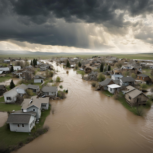
A young couple recently bought a home in Miles City, MT, where 77% of buildings sit in a flood zone
Their new home lies in a Special Flood Hazard Area (SFHA) Zoned AE.
To finance their purchase, the couple took out a loan, and their bank, following federal law, required them to buy flood insurance
Regarding the Home
The couple plans to use the home as their primary residence
It is a single-family house with a detached garage, built in 1975 near the Yellowstone River
The residence has two stories and a basement
Flooding damaged the house during events in both 1978 and 2011
The replacement cost value of the house and garage exceeds NFIP’s $250,000 maximum limit for single-family homes
The couple intends to buy the maximum building coverage available under NFIP and add $100,000 of contents coverage for their personal property
Let’s summarize what we know about the property and the couple’s coverage needs
We Know
- It is a single-family home with a detached garage
- It is a two story home with a basement
- It was built in 1975 in Miles City, MT
- It is located in a flood zone (AE)
- The couple needs $250,000 for building coverage
- The couple needs $100,000 for personal property coverage
The Process
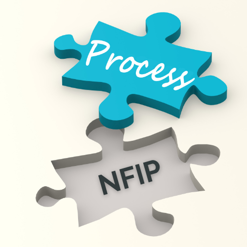
Piecing it Together
Having outlined the details about the property and the couple’s coverage needs, we will walk through the steps to determine their flood insurance rates and policy considerations
This article focuses on the first two steps: Determining the property’s status and reviewing NFIP pricing
Future articles will complete Step 2 in greater detail and explore other policy considerations and loss settlement provisions
The First Step

The Starting Point
The first step in the process is to determine whether the building is pre-FIRM or post-FIRM because this directly impacts how the property is rated and insured under the NFIP
To make this determination, we confirm that Miles City, MT participates in the NFIP program and identify the date of its first Flood Insurance Rate Map (FIRM)
Using FEMA’s NFIP Community Status Book (available HERE), we confirm that Miles City is a participating community and that its initial FIRM was issued on February 1, 1980
Since the home was built in 1975, we conclude that it is classified as a pre-FIRM building
The Second Step

Next Up!
The second step in the process requires a review of the National Flood Insurance Program’s (NFIP) approach to pricing
The NFIP employs a multifaceted methodology to calculate flood insurance premiums, ensuring that rates are actuarially sound and reflect each property’s unique flood risk
Known as Risk Rating 2.0, this approach incorporates modern technology, updated data, and advanced modeling techniques to address historical inconsistencies in rate-setting
The NFIP’s pricing methodology includes six components
- FEMA-Sourced Data: FEMA uses its own datasets, such as flood hazard maps and claims history, to assess risk
- Additional Data Sources: Federal-Government and third-party commercial data sources are integrated to enhance accuracy in risk assessment
- Cost to Rebuild Considerations: Premiums are adjusted based on the estimated cost to rebuild the structure, ensuring higher-valued properties pay rates proportional to their potential loss
- Rating Variables: Factors such as distance to water, type of flooding, foundation type, elevation, and prior claims history are used to calculate individualized premiums
- Flood Frequency: A broader range of flood frequencies is considered, including risks from river overflow, storm surges, coastal erosion, and heavy rainfall
- Fees and Surcharges: Additional charges, such as the HFIAA surcharge, are applied based on property use and occupancy (e.g., primary residence vs. rental property)
FEMA-Sourced Data

Go to the Source
FEMA’s datasets are foundational to the NFIP because they provide reliable, science-based information about flood hazards
This component of the National Flood Insurance Program’s (NFIP) Risk Rating 2.0 methodology is used to assess flood risk and calculate insurance premiums. FEMA-Sourced data includes:
Flood Hazard Maps and Geospatial Data
FEMA uses its Flood Insurance Rate Maps (FIRMs) and the National Flood Hazard Layer (NFHL), a geospatial database that contains effective flood hazard data, to identify areas at risk of flooding
These maps show flood zones, base flood elevations, and other supportive information to assess flood risk for individual properties and communities
NFIP Claims History
FEMA incorporates historical claims data from the NFIP to understand past flooding events and their impact on properties.
This helps refine risk assessments for areas with repetitive or severe flooding issues
Risk Mapping, Assessment, and Planning (Risk MAP)
Through the Risk MAP program, FEMA develops datasets that go beyond traditional flood maps.
These include hazard mitigation analysis and tools to support community resilience efforts
The program integrates FEMA’s mapping data with other resources to provide a comprehensive view of flood risk and inform local planning and development
Additional Data Sources

Hold On, It Gets Better!
Federal-government and third-party commercial data sources are integrated into FEMA’s Risk Rating 2.0 methodology to enhance the accuracy of flood risk assessments
These datasets complement FEMA’s internal information by providing additional perspectives on hazards, vulnerabilities, and structural risks
Federal-Government Data Sources
FEMA collaborates with other federal agencies to incorporate specialized datasets that improve flood risk modeling and insurance pricing
Levee Data
FEMA integrates levee performance information from the U.S. Army Corps of Engineers (USACE), which maintains the National Levee Database (NLD)
- The database includes details such as:
- Levee locations and crest elevations.
- Overtopping frequency and structural performance metrics.
- Residual flood risks for areas protected by levees.
- FEMA uses this data to assess the likelihood of levee failure or overtopping and its potential consequences, ensuring accurate risk assessments for properties near levees
National Hydrography Dataset (NHD)
FEMA incorporates hydrological data from the NHD to model water flow patterns, which is required in order to understand flood risks in watersheds
Climate Risk Projections
FEMA uses climate models from federal sources to assess future flood risks due to changing weather patterns and rising sea levels.
This integration supports long-term resilience planning
Third-Party Commercial Data Sources
Private-sector datasets provide additional granularity and insights that enhance FEMA’s risk models
Elevation Data
High-resolution elevation models from commercial vendors improve the accuracy of flood depth calculations, especially in areas where FEMA’s maps may lack detail
Building Characteristics
Remote sensing technologies and third-party databases provide information on building attributes such as first-floor elevation, foundation type, and construction materials.
These details are important for determining a property’s vulnerability to flooding
Flood Defense Systems
Commercial reports from environmental consultancies can provide insights into local flood defenses beyond federally managed systems.
These include drainage infrastructure, private levees, and temporary barriers
Cost to Rebuild Considerations

Points of Concern
Under FEMA’s Risk Rating 2.0 methodology, the cost to rebuild a structure is an important component because it helps to ensure that premiums are proportional to the potential loss, addressing long-standing inequities in the National Flood Insurance Program (NFIP)
What Does “Cost to Rebuild” Mean?
The cost to rebuild refers to the estimated expense of reconstructing a property after it is damaged or destroyed by flooding
This includes materials, labor, and other expenses required to restore the structure to its pre-flood condition
Unlike market value, which accounts for factors like location and land value, the cost to rebuild focuses solely on the physical structure
How It Impacts Premiums
- Proportional Premiums Based on Risk:
- Higher-valued properties with higher rebuilding costs now pay higher premiums because their potential loss is greater
- Conversely, lower-valued properties with lower rebuilding costs see reduced premiums, correcting historical inequities where lower-value homes often subsidized higher-value ones
- Equity in Pricing:
- The inclusion of rebuilding costs ensures that premiums are more equitable and reflect each property’s unique risk profile
- For example, two homes in the same flood zone with similar flood risks but different rebuilding costs will no longer pay the same premium under Risk Rating 2.0
- Actuarial Soundness:
- By incorporating rebuilding costs, FEMA aligns its pricing methodology with industry best practices, ensuring that rates are actuarially sound and reflect true risk
Why Was This Change Necessary?
- Addressing Historical Inequities:
- Under the previous methodology (pre-Risk Rating 2.0), premiums were largely determined by geographic zones and elevation but did not factor in rebuilding costs.
- This led to situations where lower-value homes paid disproportionately high premiums relative to their risk while higher-value homes paid less than their fair share
- Improving NFIP’s Financial Sustainability:
- By aligning premiums more closely with actual risk and potential losses, FEMA seeks to reduce its reliance on taxpayer subsidies and address the NFIP’s financial deficits caused by catastrophic flood events
- Encouraging Risk Awareness:
- Including rebuilding costs as a variable helps policyholders better understand their financial exposure and encourages mitigation efforts to reduce potential losses
Challenges and Criticisms
- Premium Increases:
- While many policyholders with lower-value homes benefit from reduced premiums, others—particularly those with high-value properties—may face significant premium increases due to higher rebuilding costs
- FEMA is legally required to cap annual premium increases at 18% for most policies, mitigating sudden rate shocks
- Complexity of Implementation:
- Calculating rebuilding costs requires detailed data on property characteristics (e.g., size, materials), which can increase administrative complexity for FEMA and insurers
Rating Variables

It’s a Game Changer!
Factors such as distance to water, type of flooding, foundation type, elevation, and prior claims history are used to calculate individualized premiums
These variables play a pivotal role in FEMA’s Risk Rating 2.0 methodology, shaping how flood insurance premiums reflect each property’s unique risk
Due to the complexity and importance of these factors, we will delve into them in greater detail in Flood Insurance Fundamentals: Part 4
Flood Frequency
We’re Doing This Again…
FEMA’s Risk Rating 2.0 considers a broader range of flood risks, including river overflow, storm surges, coastal erosion, and heavy rainfall
Incorporating these variables allows FEMA to establish premiums that more accurately reflect the likelihood of flooding for individual properties
Additionally, the rolling 10-year claims history plays a role in assessing risk and adjusting premiums for properties with repeated flooding events
Broader Flood Frequency Considerations
Risk Rating 2.0 expands the scope of flood frequency analysis beyond traditional methods by including the following types of flooding:
- River Overflow: Occurs when excessive rainfall or snowmelt causes rivers to exceed their banks, flooding nearby areas. This type of flooding can affect properties far from coastal regions
- Storm Surges: Coastal flooding caused by strong winds and low atmospheric pressure during hurricanes or tropical storms. Storm surges can inundate areas miles inland, compounding damage from rainfall
- Coastal Erosion: Gradual loss of shoreline due to wave action and rising sea levels, which increases flood risks for nearby properties
- Heavy Rainfall (Pluvial Flooding): Intense or prolonged rain that overwhelms drainage systems and causes localized flooding, even in areas not near water bodies
Rolling 10-Year Claims History
Under Risk Rating 2.0, a rolling 10-year window for claims history has been implemented, directly impacting premiums by incorporating recent flood events into the risk assessment process
This approach seeks to accurately rate properties with multiple claims within the past decade based on their increased likelihood of future losses
- Purpose
- FEMA uses claims data from the past 10 years to assess how frequently a property has experienced flooding.
- Properties with multiple claims within this window are considered higher risk and may face higher premiums
- Impact on Premiums
- The rolling window ensures that recent flood events are weighted more heavily than older incidents, providing a more accurate reflection of current risk.
- For example, a property with two or more claims in the past decade may see premium adjustments to account for its increased likelihood of future losses
- Equity and Incentives
- This approach ensures fairness by linking premiums to actual risk rather than historical anomalies or outdated data
- Property owners are incentivized to undertake mitigation measures—such as elevating structures or improving drainage systems—to reduce future claims and potentially lower premiums
Why Flood Frequency Matters
Flood frequency is a cornerstone of Risk Rating 2.0 because it provides a dynamic view of risk based on real-world conditions rather than static categorizations like flood zones alone
- By integrating diverse types of flooding and recent claims history, FEMA attempts to assure that premiums are:
- Actuarially sound
- Reflective of individual property risks
- Aligned with modern scientific understanding of flood hazards
Fees and Surcharges in NFIP Policies

Come On, Really?
Under the National Flood Insurance Program (NFIP), fees and surcharges are applied to all policies to help fund the program and address affordability concerns
One of the most notable surcharges is the HFIAA Surcharge, introduced by the Homeowner Flood Insurance Affordability Act of 2014 (HFIAA)
This surcharge varies based on property use and occupancy, ensuring that primary residences are treated differently from non-primary or rental properties
HFIAA Surcharge Details
- Primary Residences
- For primary residences, the HFIAA surcharge is $25 per year. To qualify for this lower rate, policyholders must reside in the insured property for more than 50% of the year
- Exceptions exist for active-duty military personnel, individuals displaced due to a loss event, or those hospitalized, provided they meet specific documentation requirements
- Non-Primary Residences and Rental Properties
- For non-primary residences, including rental or income properties, the HFIAA surcharge increases to $250 per year. This higher surcharge reflects the reduced affordability concerns for investment properties compared to primary homes
- Verification Requirements
- Policyholders must provide documentation to confirm primary residence status if their property address and mailing address differ. Accepted documents include automobile registration, vehicle insurance proof, or a Homestead Tax Credit form
Other Fees and Surcharges
- In addition to the HFIAA surcharge, NFIP policies include:
- Federal Policy Fee:
- A flat fee of $47 is applied to both new and renewal policies to cover administrative costs
- Reserve Fund Assessment:
- This fee is calculated as a percentage of the premium and helps build a reserve fund for catastrophic flood events
- Federal Policy Fee:
Purpose of Surcharges
- The HFIAA surcharge was designed to balance affordability for homeowners while ensuring that non-primary residences contribute proportionally to the program’s funding needs
- These surcharges also help FEMA phase out subsidized rates for older structures (pre-FIRM buildings) that previously did not reflect their full flood risk
Look How Far We Have Come

Bravo!
In Part 3 of Flood Insurance Fundamentals, we take a significant step forward by introducing a real-world case study to bring FEMA’s Risk Rating 2.0 into focus
We’ve explored the foundational components of the methodology and how these elements shape premiums
This case study sets the stage for Part 4, where we’ll continue to unravel the story.
FEMA’s rating variables are up next, and you can check them out HERE

Leave a Reply